An Atlas of
Cartographers
The same world, drawn by different hands.
I — Hobbit
A walking-map
II — Dwarf
An engineer's sheet
III — Elf
An archive of remembrance
The rest of this atlas asks what is Middle-earth? — and answers with maps that try to get the geography right. This page asks a different question: how would each people draw it?
A Hobbit of the Shire would not draw the same map as a Dwarf of Erebor, who would not draw the same map as an Elvish loremaster of Rivendell. The continent is the same. The hand is everything. Each of them cares about something different, leaves something else vague, and uses materials that say something about who they are before you read a single label.
These three maps are my attempt to coax an AI into three different in-world voices. I built a small research loop that drafts a map, scores it against an in-world rubric, and refines the prompt — round after round — until something specific to that culture emerges. None of them are perfect. None of them claim to be. But each is recognisably itself.
Beneath each chosen map I've kept two of the paths I tried but didn't pick. They're not wrong — they're just different answers to the same question.
Tim
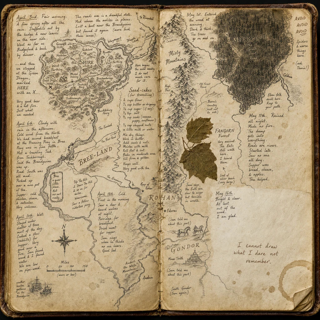
I — The Shire
A walking-map
Click to enlarge
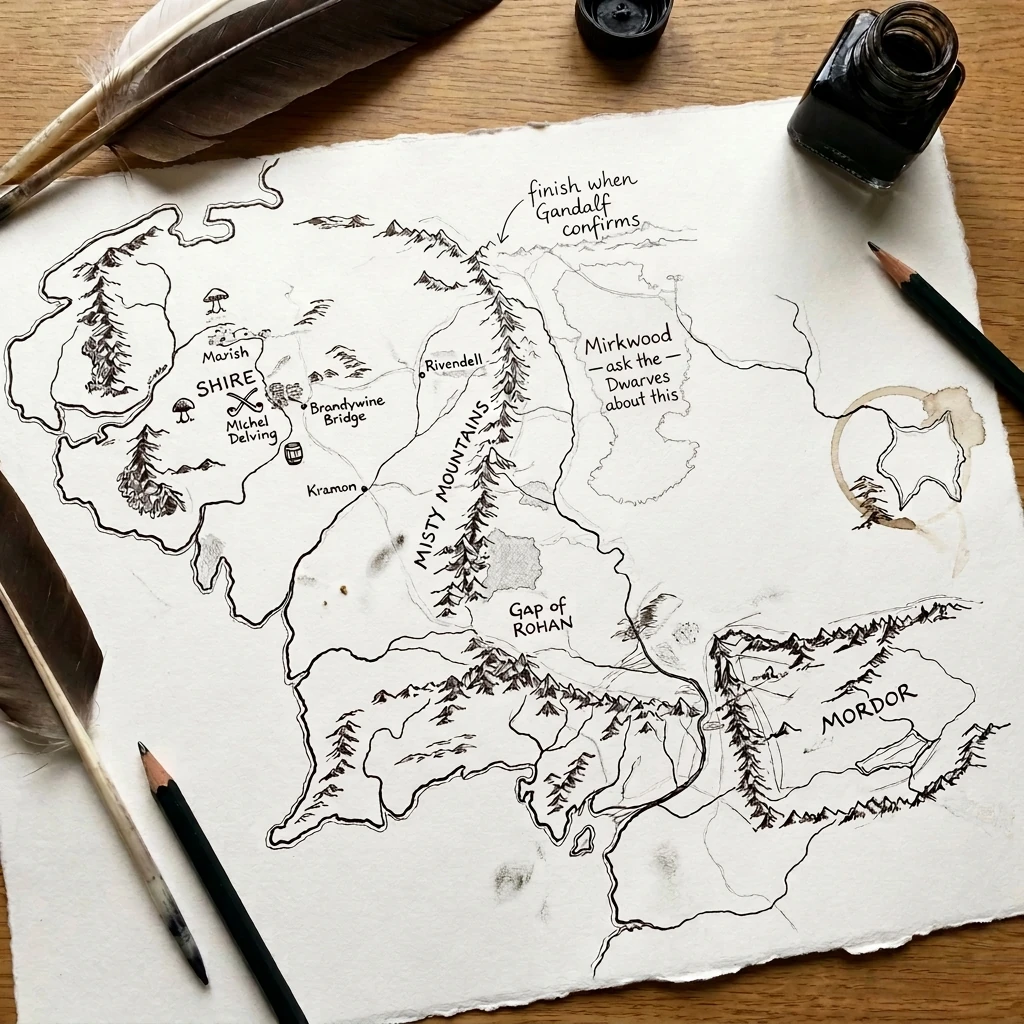
This is a personal map. Not a surveyor's map — a walker's. The Shire sits west-of-centre, dense and confident, with Marish, Michel Delving, and Brandywine Bridge labelled in a careful hand. The rest of Middle-earth thins as it moves east. The note at the top — "finish when Gandalf confirms" — gives the game away: this isn't a finished artifact, it's a Hobbit's draft, waiting on testimony from someone who's actually been to those places.
The medium gives it away too. Ink on a piece of paper that's been carried, creased and tea-stained, photographed flat on a wooden table beside the tools that made it. Where Mirkwood should be, the paper carries an actual coffee-cup ring — and right next to it, in the same careful hand: "Mirkwood — ask the Dwarves about this." The forest is literally a stain. Hobbits are honest about what they don't know.
- The Shire dense and confident west-of-centre; Mordor's outline in the far east reduced to a few quick strokes.
- "finish when Gandalf confirms" — written at the top, pointing into the Misty Mountains. A draft, not a record.
- A coffee-ring where Mirkwood ought to be, with "Mirkwood — ask the Dwarves about this" annotated beside it. The forest is rendered as a stain.
- A photograph, not a scan. Quill, ink-bottle, two pencils — the map as a thing being made on a table.
Paths not taken
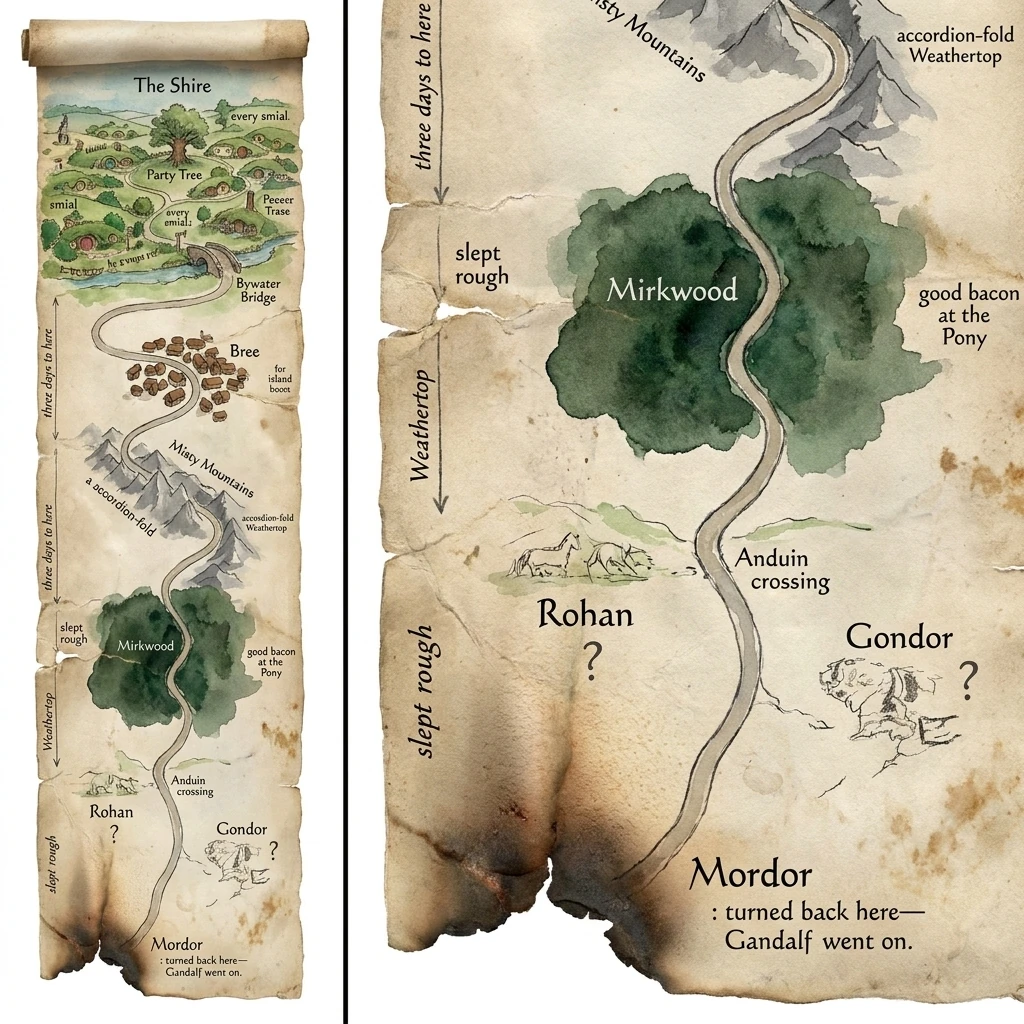
The scroll format
A walking-map as an unfurled scroll — physical form doing the work of scale. Loses some southern legibility, but the format itself is the argument.
An open journal
The Hobbit as diarist — margin recipes, weather notes, no white space spared. A different kind of personal artifact, closer to a story than a map.
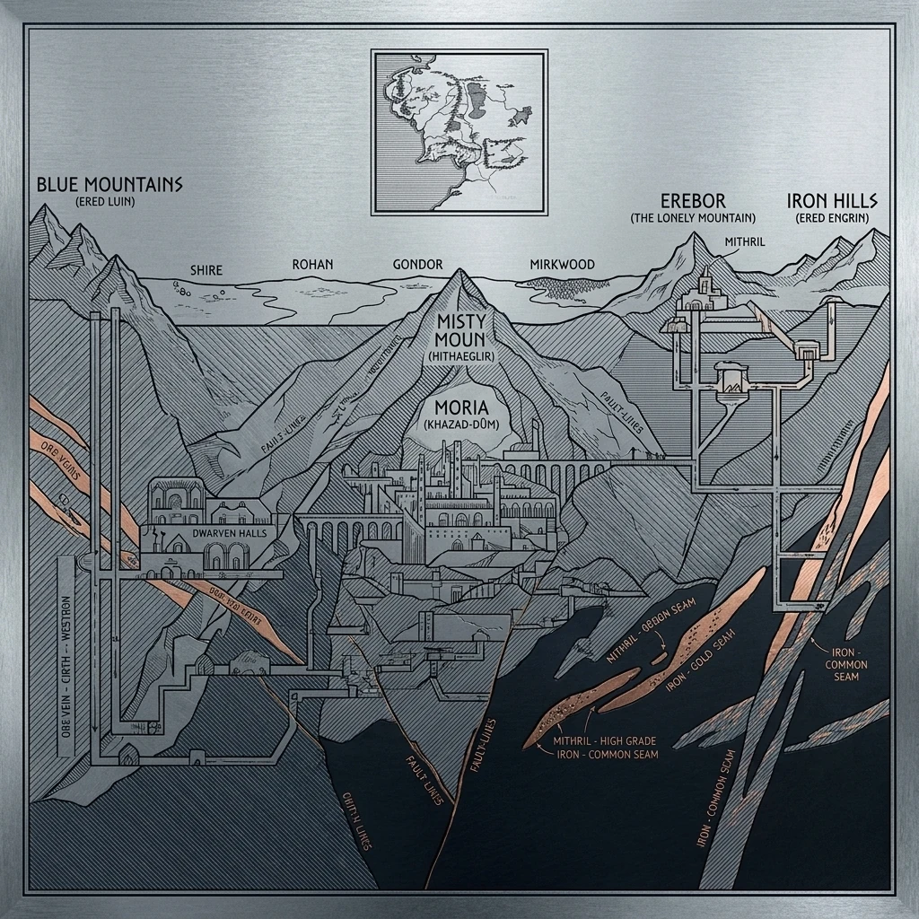
II — Erebor & the Mountains
An engineer's sheet
Click to enlarge
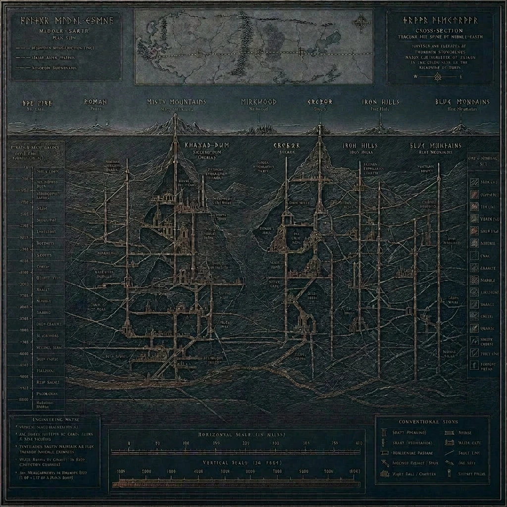
Where the Hobbit map is a walker's record, this is an engineer's working sheet. The world is read from below. A thin row of surface peaks runs across the top — Misty Mountains, Mirkwood, Erebor, Iron Hills, Blue Mountains — but the work is what lies beneath them: the carved cross-sections of Khazad-dûm, Erebor, the Iron Hills, with their halls, shafts, and copper-veined ore-bodies drawn in the same disciplined hand.
The medium is the message. It's designed to read as incised into hammered copper-plate — every line ruled, every angle measured. The title across the top reads "MIDDLE-EARTH" in angular Dwarvish runes with a small Westron gloss beneath, and a separate "CROSS-SECTION" legend faces it on the right. Down the left margin runs a column of depth measurements and ore-grade notations. No marginalia, no whimsy. The Dwarves do not draw a map; they build one.
- Cross-section primary, plan view secondary. The world is vertical, not flat.
- A horizon-line of surface peaks at the top (Misty Mountains, Mirkwood, Erebor, Iron Hills, Blue Mountains) — surface kingdoms reduced to landmarks.
- Title in angular Dwarvish runes with a Westron gloss beneath; technical notations in plain script everywhere else.
- Depth measurements down the left margin, horizontal and vertical scale bars along the bottom — the apparatus of a working document.
Paths not taken
The engineer's variant
Same engineering voice, different hand — favours legible ore annotations and a working-document feel over the polished copper-plate refinement.
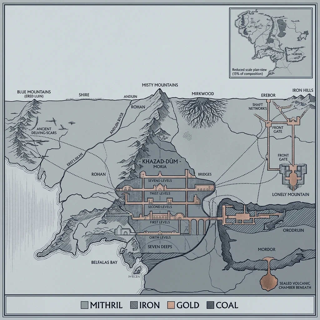
Depth as data
A version that pushed deeper into geology — labelled depth scales, hatching for strata, an ore-type legend. Almost too readable; not quite austere enough.
III — Imladris
An archive of remembrance
Click to enlarge
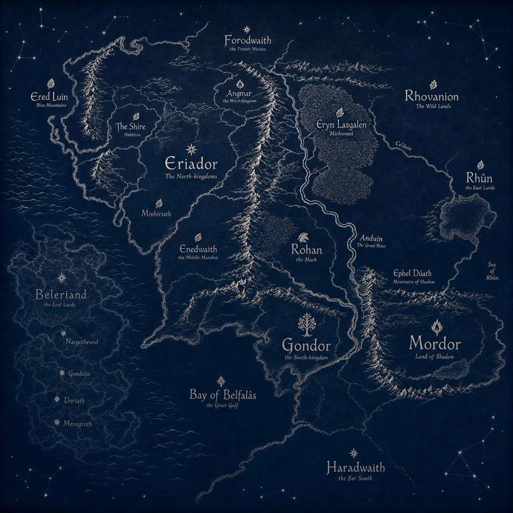
The Elves remember everything. So their map isn't a snapshot — it's a record. The continent is drawn calmly, with much breathing room, in silver line on indigo vellum. Every region wears two names: the elder Sindarin first (in a calm italic), and a smaller Westron gloss beneath as if for kin who haven't been here as long. Eryn Lasgalen / Mirkwood. Bay of Belfalâs / the Great Gulf. Ered Luin / Blue Mountains. The naming itself is the loremaster's instrument — the older tongue first, the mortal name afterthought.
And then there is the west. To the left of the Blue Mountains, where mortal maps stop at the coast, this one keeps going. The lost kingdoms of Beleriand — Nargothrond, Gondolin, Doriath, Menegroth — sit faded to ghost-line, half beneath the waves of the Belegaer. They were drowned at the end of the First Age. To a Hobbit they are not real. To an Elf they are still where they used to be. That is the Elvish lens: the present is shallow; the deep past is real.
- Silver line on indigo vellum. Darkness as ground, light as figure — the inverse of mortal maps.
- Every region wears two names: Sindarin first in calm italic, Westron beneath as gloss. Eryn Lasgalen / Mirkwood. Bay of Belfalâs / the Great Gulf.
- Beleriand drawn in beneath the sea, west of the Blue Mountains: Nargothrond, Gondolin, Doriath, Menegroth — labelled where they used to be.
- Constellations sketched along the borders. An Elvish loremaster reads the heavens and the land as one document.
Paths not taken
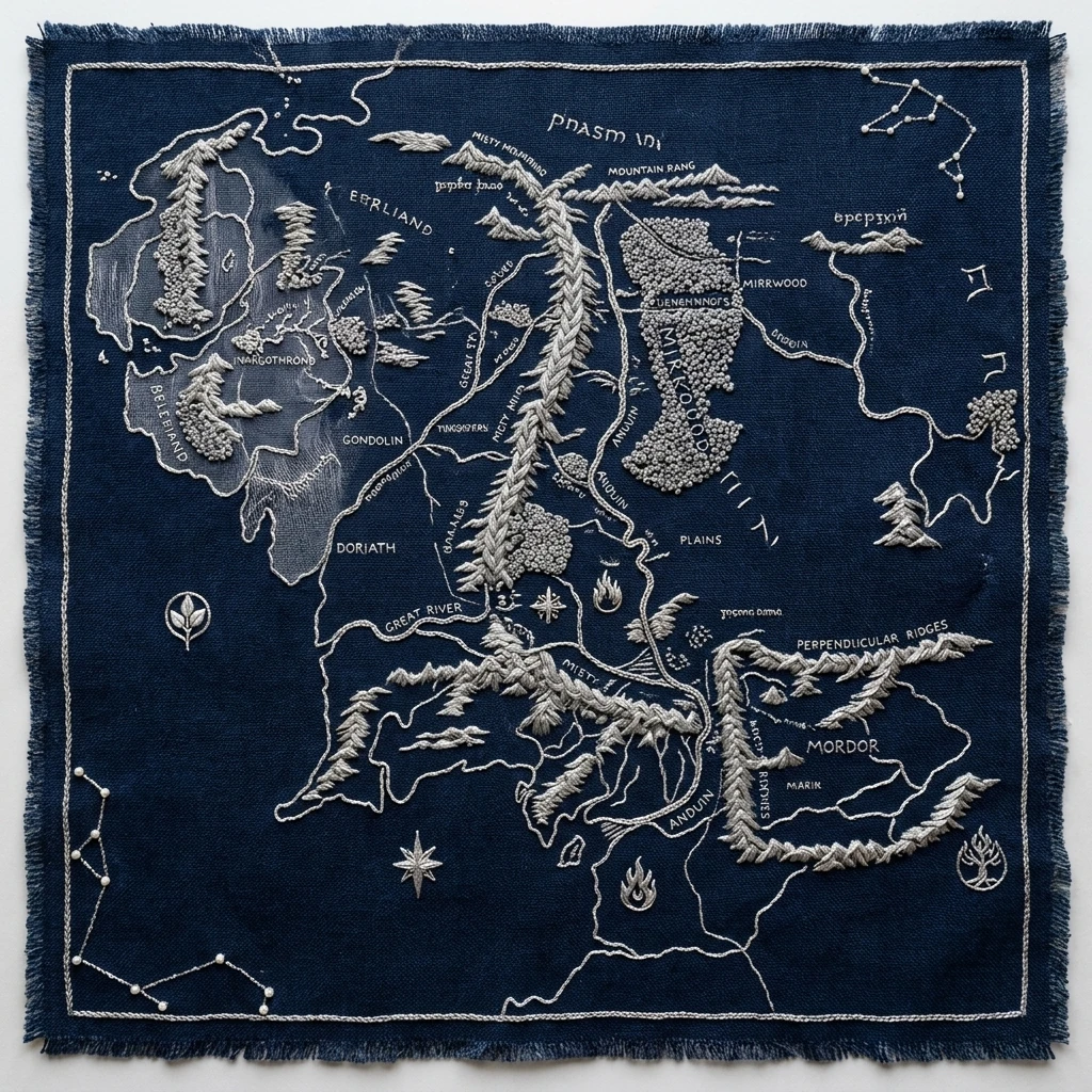
A woven artifact
What if the map were a tapestry, not a manuscript? Silver thread on dark wool. The metaphor stays in the Elvish register; the legibility suffers.
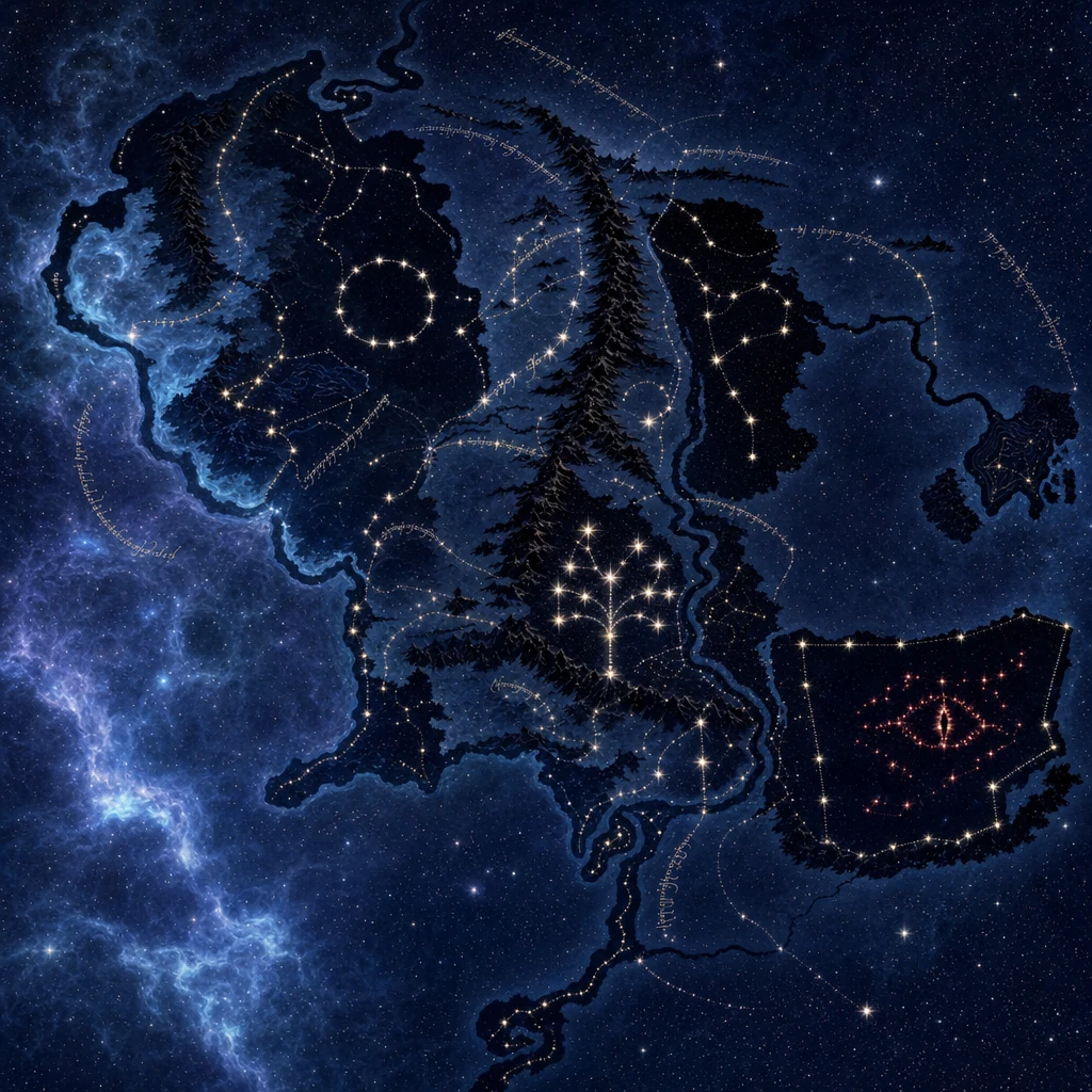
A celestial reading
The most radical departure — geography read as constellations, Mordor as a red star. Beautiful, but no longer quite cartography.